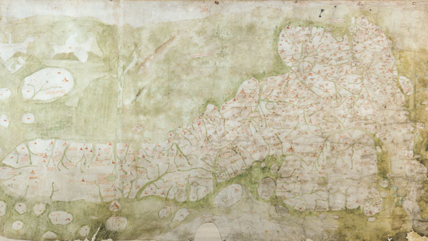
 This is the earliest surviving map of Britain – the Gough Map. It dates from the 1370s, and was revised in the early Fourteenth Century. The BBc article linked below comments, “drawn on two pieces of sheepskin, the 115 x 56cm (45 x 22 in) artefact depicts Great Britain on its side, before the convention of maps pointing north.” He continues, “It is the prototype of modern English cartography. It shows real geography as opposed to theology which earlier maps tended to show…the additional beauty is you’ve got at least 600 place names there so it’s a wealth of information from the late Middle Ages and it’s relatively accurate.”
Interactive Gough Map Homepage
If you would like to see how contrasting a series of maps can help historians, then watch / listen to this excellent audio slideshow about the African archives held by the Royal Geographical Society.